Development of the information system for monitoring time changes in forest plantations based on the analysis of space images
DOI:
https://doi.org/10.15587/1729-4061.2022.265039Keywords:
information system, satellite images, forest lands, monitoring, correlation-regression analysis, time changesAbstract
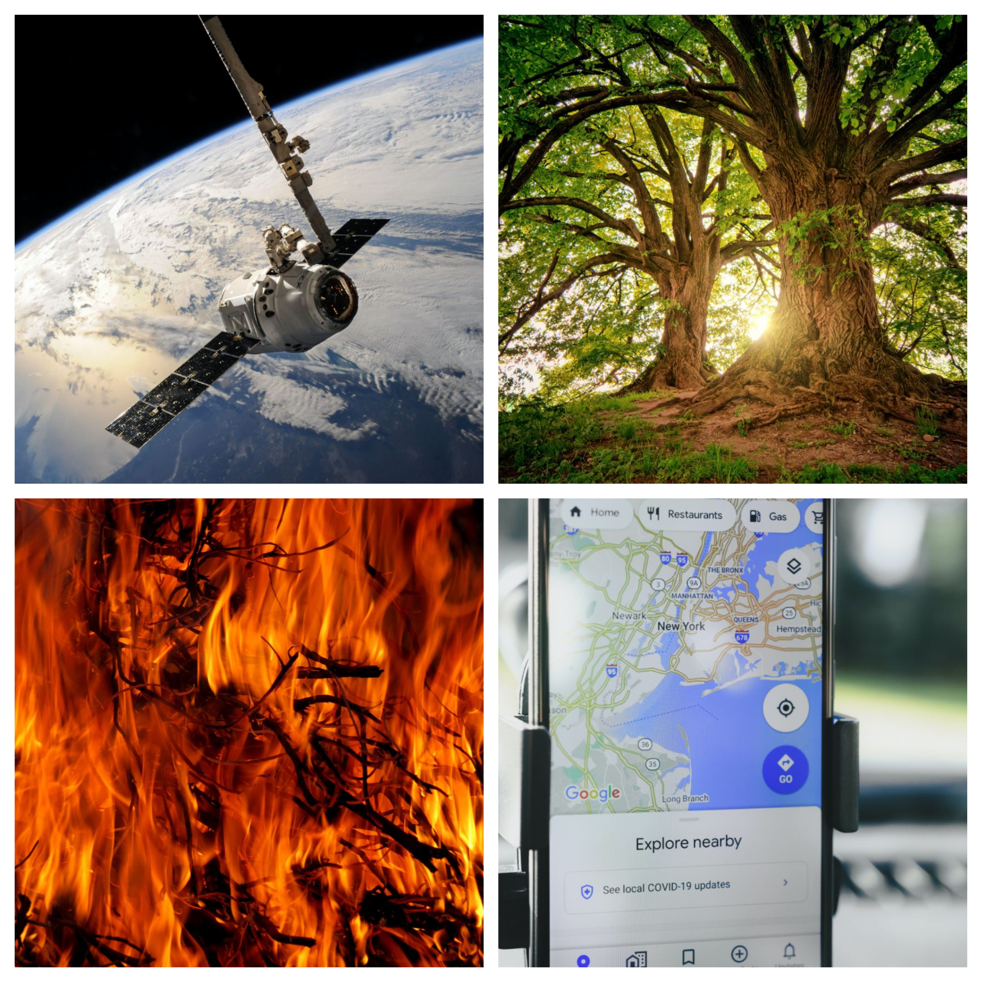
This study considers the issue of assessing the time changes in forest plantations and constructing an algorithmic and software system for monitoring these changes. Modern systems that study vegetation changes do not have the necessary functionality and do not cover the range of observations discussed in this paper. Existing research methods are intended only to record changes that occur in forest ecosystems and take into consideration the peculiarities of a certain natural zone, which limits their use. At the same time, it should be understood that the requirements for modern systems should include additional components that could make the system universal and mobile. A comparative analysis of satellite images acquired from remote sensing by the Landsat 8 satellite system has been carried out to determine the areas affected by forest fires. During the classification, spectral analysis was used, and an index of fires was determined to indicate the burned areas. To analyze the changes that occur in forests due to fires, correlation-regression analysis is used. It has been proven that the area of sanitary felling after fires and the area of forest land traversed by fires demonstrated the greatest interconnection. The extrapolation and forecasting were carried out using a regression data model, the effectiveness of which is confirmed by a coefficient of determination of 0.87. The dependences built make it possible to conclude that by 2030 the number of forest fires will increase while the area of burned forests will not decrease. The developed mobile application could be popular among a significant group of users to monitor fire events. The practical result is the introduction of the built system, which makes it possible to quickly monitor forest plantations after fires and assess the areas that were affected.
References
- Zheng, Z., Huang, W., Li, S., Zeng, Y. (2017). Forest fire spread simulating model using cellular automaton with extreme learning machine. Ecological Modelling, 348, 33–43. doi: https://doi.org/10.1016/j.ecolmodel.2016.12.022
- Palmieri, L., Jensen, H. J. (2020). The Forest Fire Model: The Subtleties of Criticality and Scale Invariance. Frontiers in Physics, 8. doi: https://doi.org/10.3389/fphy.2020.00257
- Barabash, O., Bandurka, O., Shpuryk, V., Svynchuk, O. (2021). Information system of analysis of geodata for tracking changes of vegetation. Advanced Information Systems, 5 (4), 17–25. doi: https://doi.org/10.20998/2522-9052.2021.4.03
- Barabash, O., Bandurka, O. (2022). Modeling of forest fires based on the Bayesian forecast model and geoinformation technologies. Advanced Information Systems, 6 (1), 19–26. doi: https://doi.org/10.20998/2522-9052.2022.1.03
- Oleksandr, L. (2019). The Method of Hidden Transmitters Detection based on the Differential Transformation Model. International Journal of Advanced Trends in Computer Science and Engineering, 8 (6), 2840–2846. doi: https://doi.org/10.30534/ijatcse/2019/26862019
- Smelyakov, K., Tovchyrechko, D., Ruban, I., Chupryna, A., Ponomarenko, O. (2019). Local Feature Detectors Performance Analysis on Digital Image. 2019 IEEE International Scientific-Practical Conference Problems of Infocommunications, Science and Technology (PIC S&T). doi: https://doi.org/10.1109/picst47496.2019.9061331
- Khudov, H. (2020). The Multiscale Image Processing Method from On-board Earth Remote Sensing Systems Based on the Artificial Bee Colony Algorithm. International Journal of Advanced Trends in Computer Science and Engineering, 9 (3), 2557–2562. doi: https://doi.org/10.30534/ijatcse/2020/11932020
- Ruban, I., Khudov, H. (2019). Swarm Methods of Image Segmentation. Studies in Computational Intelligence, 53–99. doi: https://doi.org/10.1007/978-3-030-35480-0_2
- Sobchuk, V., Barabash, O., Musienko, A., Svynchuk, O. (2021). Adaptive accumulation and diagnostic information systems of enterprises in energy and industry sectors. E3S Web of Conferences, 250, 08002. doi: https://doi.org/10.1051/e3sconf/202125008002
- Bardysh, B., Burshtynskaya, Kh. (2014). Using vegetation indices to identify objects on the earth surface. Suchasni dosiahnennia heodezychnoi nauky ta vyrobnytstva, 2, 82–88. Available at: http://nbuv.gov.ua/UJRN/sdgn_2014_2_21
- Korchagina, I. A., Goleva, O. G., Savchenko, Y. Y., Bozhikov, T. S. (2020). The use of geographic information systems for forest monitoring. Journal of Physics: Conference Series, 1515 (3), 032077. doi: https://doi.org/10.1088/1742-6596/1515/3/032077
- Candiago, S., Remondino, F., De Giglio, M., Dubbini, M., Gattelli, M. (2015). Evaluating Multispectral Images and Vegetation Indices for Precision Farming Applications from UAV Images. Remote Sensing, 7 (4), 4026–4047. doi: https://doi.org/10.3390/rs70404026
- Ruban, I., Khudov, V., Khudov, H., Khizhnyak, I. (2017). An improved method for segmentation of a multiscale sequence of optoelectronic images. 2017 4th International Scientific-Practical Conference Problems of Infocommunications. Science and Technology (PIC S&T). doi: https://doi.org/10.1109/infocommst.2017.8246367
- Serkov, A., Kravets, V., Yakovenko, I., Churyumov, G., Tokariev, V., Nannan, W. (2019). Ultra Wideband Signals in Control Systems of Unmanned Aerial Vehicles. 2019 10th International Conference on Dependable Systems, Services and Technologies (DESSERT). doi: https://doi.org/10.1109/dessert.2019.8770039
- Churyumov, G., Tokarev, V., Tkachov, V., Partyka, S. (2018). Scenario of Interaction of the Mobile Technical Objects in the Process of Transmission of Data Streams in Conditions of Impacting the Powerful Electromagnetic Field. 2018 IEEE Second International Conference on Data Stream Mining & Processing (DSMP). doi: https://doi.org/10.1109/dsmp.2018.8478539
- Gunchenko, Y., Lienkov, S., Husak, Y., Shvorov, S., Zaitsev, D. (2020). Model of Functioning Data-Transfer Systems Special Purposes Taking into Account the Influence of Cyber Attack. International Journal of Innovative Technology and Exploring Engineering, 9 (6), 2248–2252. doi: https://doi.org/10.35940/ijitee.e3050.049620
- Tokar, O., Korol, M., Havryliuk, S., Cunjak, A. (2017). Application of satellite images for the estimation of forest inventory indices. Heodeziya, kartohrafiya i aerofotoznimannia, 85, 84–93. Available at: https://ena.lpnu.ua/handle/ntb/42799
- Benguerai, A., Benabdeli, K., Harizia, A. (2019). Forest Fire Risk Assessment Model Using Remote Sensing and GIS Techniques in Northwest Algeria. Acta Silvatica et Lignaria Hungarica, 15 (1), 9–21. doi: https://doi.org/10.2478/aslh-2019-0001
- Shvaiko, V., Bandurka, O., Shpuryk, V., Havrylko, Y. V. (2021). Methods for detecting fires in ecosystems using low-resolution space images. Informatyka, Automatyka, Pomiary w Gospodarce i Ochronie Środowiska, 11 (1), 15–19. doi: https://doi.org/10.35784/iapgos.2576
- Hryhorenko, I., Kondrashov, S., Hryhorenko, S. (2021). Development and research of the parameters control system of the artificial ecosystem environment by the fuzzy-logic system. Advanced Information Systems, 5 (4), 49–54. doi: https://doi.org/10.20998/2522-9052.2021.4.07
- Pashchenko, R., Mariushko, M. (2021). Evaluation of the speed of the plant photosynthesis process with a fuzzy description of impact factors and indicators. Advanced Information Systems, 5 (3), 31–39. doi: https://doi.org/10.20998/2522-9052.2021.3.05
- InciWeb – Incident Information System. Available at: https://inciweb.nwcg.gov/
- Cal Fire. Available at: https://www.fire.ca.gov/
- Ponomarenko, M. R., Zelentsov, V. A. (2021). Forest monitoring and analysis based on Earth observation data services. IOP Conference Series: Earth and Environmental Science, 806 (1), 012003. doi: https://doi.org/10.1088/1755-1315/806/1/012003
- WorldView. Available at: https://worldview.earthdata.nasa.gov/
- Valente de Almeida, R., Vieira, P. (2017). Forest Fire Finder – DOAS application to long-range forest fire detection. Atmospheric Measurement Techniques, 10 (6), 2299–2311. doi: https://doi.org/10.5194/amt-10-2299-2017
- Teguh, R., F. Adji, F., Benius, B., Nur Aulia, M. (2021). Android mobile application for wildfire reporting and monitoring. Bulletin of Electrical Engineering and Informatics, 10 (6), 3412–3421. doi: https://doi.org/10.11591/eei.v10i6.3256
- Clearcut from quantum: deforestation tracking. Available at: https://it-kharkiv.com/en/clearcut-from-quantum-deforestation-tracking/
- What are the band designations for the Landsat satellites? Available at: https://www.usgs.gov/faqs/what-are-band-designations-landsat-satellites
- Foster, J. R. (2001). Statistical power in forest monitoring. Forest Ecology and Management, 151 (1-3), 211–222. doi: https://doi.org/10.1016/s0378-1127(01)00591-6
- Ruiz-Ramos, J., Marino, A., Boardman, C., Suarez, J. (2020). Continuous Forest Monitoring Using Cumulative Sums of Sentinel-1 Timeseries. Remote Sensing, 12 (18), 3061. doi: https://doi.org/10.3390/rs12183061
- Buba, F. N., Gajere, E. N., Ngum, F. F. (2020). Assessing the Correlation between Forest Degradation and Climate Variability in the Oluwa Forest Reserve, Ondo State, Nigeria. American Journal of Climate Change, 09 (04), 371–390. doi: https://doi.org/10.4236/ajcc.2020.94023
- Pashynska, N., Snytyuk, V., Putrenko, V., Musienko, A. (2016). A decision tree in a classification of fire hazard factors. Eastern-European Journal of Enterprise Technologies, 5 (10 (83)), 32–37. doi: https://doi.org/10.15587/1729-4061.2016.79868
Downloads
Published
How to Cite
Issue
Section
License
Copyright (c) 2022 Olha Svynchuk, Olena Bandurka, Oleg Barabash, Oleh Ilin, Andrii Lapin

This work is licensed under a Creative Commons Attribution 4.0 International License.
The consolidation and conditions for the transfer of copyright (identification of authorship) is carried out in the License Agreement. In particular, the authors reserve the right to the authorship of their manuscript and transfer the first publication of this work to the journal under the terms of the Creative Commons CC BY license. At the same time, they have the right to conclude on their own additional agreements concerning the non-exclusive distribution of the work in the form in which it was published by this journal, but provided that the link to the first publication of the article in this journal is preserved.
A license agreement is a document in which the author warrants that he/she owns all copyright for the work (manuscript, article, etc.).
The authors, signing the License Agreement with TECHNOLOGY CENTER PC, have all rights to the further use of their work, provided that they link to our edition in which the work was published.
According to the terms of the License Agreement, the Publisher TECHNOLOGY CENTER PC does not take away your copyrights and receives permission from the authors to use and dissemination of the publication through the world's scientific resources (own electronic resources, scientometric databases, repositories, libraries, etc.).
In the absence of a signed License Agreement or in the absence of this agreement of identifiers allowing to identify the identity of the author, the editors have no right to work with the manuscript.
It is important to remember that there is another type of agreement between authors and publishers – when copyright is transferred from the authors to the publisher. In this case, the authors lose ownership of their work and may not use it in any way.


